Skip to content

Trails for walking, biking and skiing

Salpausselkä Trails

The Salpausselkä area has a large trail network. The marked trails are meant for everyone: walkers, runners and cyclists. There are about 25 kilometres of waymarked trails.

The trails offer a low-threshold opportunity to exercise in a natural forest environment. The Salpausselkä recreational area has marked trails that are easy to follow even for the less experienced hikers and cyclists. The marked trails are meant for both walking and biking. Dogs are welcome and should be kept on a leash.

Since there is also a demand for marked trails in winter, the forest trails have been designed for year-round use. When the snow is deep, you can walk on the trails with snowshoes, for example. Please note, that you shouldn’t walk on the skiing tracks.

The marked trails were put on existing forest paths. The forest trails are located within the Sports Centre-Tapanila-Hakalaukku-Kintterönsuo area. In total, there are about 25 kilometres of marked trails.

Some of the trails intersect with the new Hollola Suoreitti. The Suoreitti trail is marked with wooden signs and yellow paint.

The shared-use path sign leads you to the marked paths.

Marked trails in Salpausselkä

  • Hakalaukun lenkki

    • Trail length: about 7 kilometres, loop trail  (trail signs and counterclockwise rotation)
    • Difficulty level: medium hard / easy in parts
    • Trail signs: purple arrows

    Hakalaukun polku

    Hakalaukunpolku is a shorter version of Hakalaukunlenkki. The shortcut is marked on both ways.

    • Trail length: about 5,3 kilometres, loop trail (trail signs and counterclockwise rotation)
    • Difficulty level: medium hard / easy in part
    • Trail signs of the shortcut: violet arrow with dashed lines

    • Duration: mountainbike 45 minutes, on foot 1–2,5 hours.
    • Trail length: about 10 kilometres, loop trail (trail signs and clockwise rotation)
    • Difficulty level: medium hard / difficult in parts
    • Trail signs: red arrows

    • Trail length: about 3 kilometres, loop trail (trail signs and counterclockwise rotation)
    • Difficulty level: easy
    • Trail signs: blue arrows

    • Duration: mountain bike 20–40 minutes, on foot 45 minutes–1,5 hours
    • Starting point: Vaskelaisenrinne 11
    • Trail length: about 2,9 kilometres, point-to-point trail
    • Difficulty level: easy
    • Trail signs: green arrows

    • Duration: mountain bike 20–50 minutes, on foot 45 minutes–1,5 hours
    • Starting point: Vaskelaisenrinne 11
    • Trail length: about 3,5 kilometres, point-to-point trail
    • Difficulty level: easy / medium hard
    • Trail signs: pink arrows

    • Duration: mountain bike 20–40 minutes, on foot 1–2 hours
    • Starting point: Vaskelaisenrinne 11

Salpausselkä Trails on map

Skip embed

Remember to bring a map

Always bring a map with you or use a mobile map with a location feature (kartta.lahti.fi > vapaa-aika ja liikunta). Printable PDF maps are available for each route. Trails signs are sometimes vandalised, so a map may come in handy!

  • The forest trails run in a natural environment. The trails are not constantly maintained.

    • The trail network consists of narrow, winding forest paths.
    • The trails have uneven terrain with roots, rocks, stones and holes.
    • The terrain can be steep and wet in places.
    • The forest trails are not accessible.

    The best way to ensure safety is through your own actions!

    • Select a route that is suitable for your skill and fitness level.
    • When preparing, remember that the season and weather conditions have an impact on the difficulty level.
    • In rainy weather or slippery conditions, the trails become more difficult. Carefully estimate your skills.
    • If it is dark, bring a headlamp with you or use proper bike lights.
    • Adjust your speed to ensure the safety of yourself and others.
    • The person who is going faster watches out for the people moving slower. The person coming up from behind watches our for the person in front.

    When you exercise in nature, there are always certain risks involved.

    • The best way to ensure safety is through your own actions.
    • Prepare according to the type of activity and weather conditions.
    • Don’t take any unnecessary risks. Make sure that you are covered by insurance.
    • Download the 112 Suomi application to your phone and, if necessary, a mobile map application.

    Dogs should always be kept on a leash – even obedient dogs!


  • The marked trails can be used in winter on foot, on a fat bike or on snowshoes, depending on the snow conditions.

    • Trails are not maintained in winter. Watch out, the ground can be slippery!
    • Please note that after heavy snowfall or a snowstorm, the trails can be covered in snow.
    • During the skiing season, maintained ski trails are for skiing only.
      • You can cross the ski trail, but remember to watch out for skiers and avoid damaging the trail
      • Use marked paths when crossing the ski trail.
    • The forest trails do not have lighting but all trail signs are of reflective material.
      • When it is dark outside, be sure to use a headlamp and reflectors when walking or biking on forest trails to ensure that others can see you.
      • If it gets dark suddenly, you can find lighted routes near the easiest forest trails.
      • Mountain biking in the dark requires good skills and good bike lights. Don’t forget to take a spare battery or spare lights with you!
    • Call the emergency number 112. Tell them your location and what has happened.
    • Help in any way you can.
    • Direct the helpers to the location.

    When you make the call in the 112 Suomi application, the emergency centre can see your location automatically.

    • The forest trails are maintained by the municipal engineering division of the City of Lahti.
    • The trails are not constantly maintained. The forest trails run in a natural environment.
    • If you notice any hazards or vandalism along the trails, please send feedback through the electronic feedback service.

Skiing tracks

Lahti and the Salpausselkä ridges have a total of around 180 kilometres of cross-country ski trails, 70 kilometres of which have lighting. The excellent network of ski and hiking trails is an easy and accessible way to exercise in nature both in summer and winter. Fitness enthusiasts, beginners and families can all find a ski trail that suits their fitness and skill level.

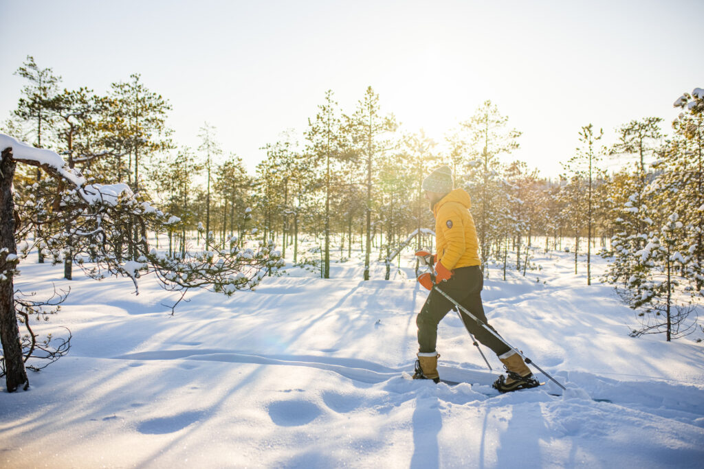
In winter, the trails are reserved for skiing only. Walking and walking dogs on the ski trails is prohibited. In winter, the frozen lakes are a great opportunity for walking, ice skating and skiing if the weather conditions permit.

On the ski trails, the lights are on from 6 a.m. to 10:30 p.m.